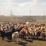
The Saskatchewan Cattlemen’s Association is emphasizing the importance of biosecurity and record keeping after a positive case of bovine tuberculosis was traced to a cattle herd in that province.
Things are looking not too bad for those who want to see snow or deep freeze temperatures. As we start this forecast period, a strong area of Arctic high pressure is dropping southeastwards over the eastern Prairies behind the strong area of low pressure that zipped through on Tuesday. Over the western Prairies, the weather models show a strong ridge of high pressure building over B.C. which is expected to transition eastwards.
For the week ending November 29, feeder cattle market reports from Manitoba had prices up $20-$40/cwt from week-ago levels. Prices in Saskatchewan and Alberta were up $10 to $20 on average. The market was hard to define this past week with a wide range prices across Western Canada for similar quality and weight cattle.
For this forecast period, it looks like some of the coldest air of the season is on its way to Saskatchewan while most of Alberta and Manitoba appear to miss the really cold stuff. The weather models are not showing any strong storm systems impacting the region but there a few weak systems that may bring a light shot of snow here and there.
For the week ending November 23, Western Canadian feeder cattle markets traded $3 to $6 higher with some quality heifer packages up as much as $10 compared to seven days earlier.
You might be happy to know (or maybe not) that for this forecast period we should see a quieter but colder weather pattern across the Prairies. Arctic high pressure will be pulled southwards behind the eastern Prairie low and brings the first really taste of winter.
Stay in the know about the latest in agriculture. Thousands of topics, all carefully curated to match your interests! The app is now available for download on iOS and Android.